
01
Peatland restoration baselining
Accurate peat depth across a site before works, for restoration design and carbon accounting.
Peat depth, strata and bedrock resolved without a single footprint on the ground you are mapping. Drone-mounted ground penetrating radar and fluxgate magnetometry together give engineering teams a continuous subsurface profile where walking a survey simply would not work.
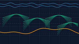
Our GPR payloads are flown at controlled altitude and spacing, transmitting into the substrate and recording the returned signal as a continuous radargram. Because the survey is non-contact, soft peat, standing water, sensitive habitats and live utility corridors are measured as-is — no traffic management, no ground disturbance and no access negotiation.
Complementary fluxgate magnetometry detects ferrous and conductive anomalies for utility tracking and buried asset mapping. When the two are flown together on the same grid, subsurface structure and buried services are reconciled into a single, coordinate-consistent subsurface model.
Every line is differentially corrected and georeferenced. Interpretation is returned as standard deliverables — radargram sections, depth models, anomaly plans and geometry — ready to load straight into the GIS your engineering team already uses.
 Division 01
Method
Grid plan, sensor selection and CAA-compliant flight design agreed with your consenting team.
Manned flight lines flown at constant altitude; GPR and magnetometry data logged against base station corrections.
Radargrams migrated and filtered; anomalies classified against site geology and buried-service records.
Subsurface model and anomaly plan issued with a validation note and GIS-ready source files.
Deliverables
Standard outputs, delivered in a format your engineering and consenting teams can use immediately.
Typically Applied To
01
Accurate peat depth across a site before works, for restoration design and carbon accounting.
02
Bedrock and strata mapping under access tracks and tower positions without stopping live assets.
03
Buried services and historical ground structure mapped before groundworks start.
Continue Reading