Six Specialist Divisions. One Subsurface-to-Sky Survey Chain.

Every commission is run as a single integrated chain — subsurface geophysics, airborne topography, thermal diagnostics and environmental baseline, coordinated by one geospatial engineering team and delivered in the formats your engineers already work in.

Drone GPR surveyed: 50+ km Single-site coverage: 2,000+ ha Delivery: ArcGIS / QGIS

Divisions

Choose the disciplines your scheme needs

Division 01

Subsurface GPR & Magnetometry

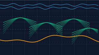
Peat depth, subterranean strata, bedrock mapping and utility corridors resolved without ground disruption. Drone-mounted ground penetrating radar and fluxgate magnetometry deliver full subsurface intelligence over 50+ km per campaign.
50+ km flownPeat / strata / utilities

View capability

GPR radargram showing hyperbolic diffractions over a bedrock reflector
Division 02

Airborne LiDAR & Topography

Sub-canopy terrain modelling, asset clearance surveying, volume analysis and exact bare-earth elevation profiles for corridor and site engineering.

Bare-earth DTMClearance mapping

View capability

LiDAR point cloud resolving bare-earth terrain beneath vegetation canopy
Division 03

Thermal & Infrastructure Analysis

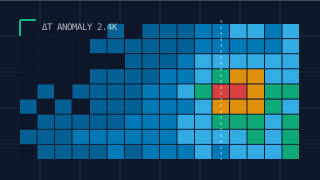
High-resolution thermal imaging for energy network condition surveys, moisture mapping, vegetation impede thermal capture and corridor anomaly detection.

ΔT anomaly detectionNetwork condition

View capability

Thermal raster showing a heat anomaly over a survey grid
Division 04

Specialised Radiological Surveys

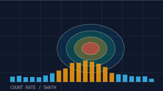
Non-contact aerial radiation detection and mapping, contamination tracking and natural or industrial radiological site characterisation.

Academic sensor MOURegulator-defendable

View capability

Radiological dose plume over a survey swath with count-rate histogram
Division 05

Environmental & Habitat Mapping

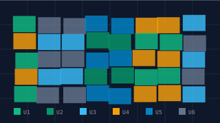
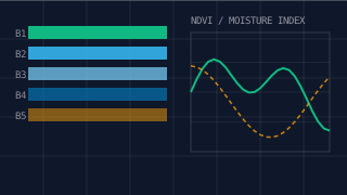
Peatland restoration profiling, UK Habitat classifications, vegetation stress and moisture analysis, and defensible carbon baselining from multispectral and hyperspectral imagery.

UKHAB classificationCarbon baseline

View capability

UK Habitat class polygon mosaic with legend swatches
Division 06

Fuel Sectors Geomapping

Geospatial mapping for oil and gas estates — over 150 sites surveyed and delivered as GIS-ready asset datasets, reviewed and expanded on request.

150+ sites mappedGIS-ready assets

Discuss a fuel sector survey

Multispectral band stack with vegetation index strip chart

Consistent Outputs

What every commission delivers

The output package is standardised so your engineering, environmental and consenting teams can act on it immediately, whatever the discipline mix.

50+ kmDrone GPR surveyed
2,000+ haSingle-site coverage
150+Oil & gas sites mapped
1Geospatial engineering team

Start a Scheme

Brief Our Geospatial Engineers On Your Corridor

Tell us the scale, the disciplines you need and the format your engineering team works in. We will return a survey concept, instrumentation plan and delivery schedule.